


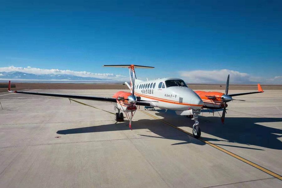
Aero Geological Survey No. 1 (Photo provided by China Geological Survey)
The aircraft is the world's first and only aerial platform that can be used to conduct gravity, magnetic field, aerial photography and hyperspectral remote sensing surveys, according to the China Geological Survey under the Ministry of Natural Resources.
TIANJIN, Oct. 12 (Xinhua) -- The world's leading aircraft for aero geophysical and remote sensing surveys manufactured by China has made a public appearance at an ongoing mining conference in the city of Tianjin.
The aircraft, known as Aero Geological Survey No. 1, is the world's first and only aerial platform that can be used to conduct gravity, magnetic field, aerial photography and hyperspectral remote sensing surveys, according to the China Geological Survey under the Ministry of Natural Resources.
It is capable of flying at altitudes of 200 to 10,000 meters at a speed of 280 to 500 km per hour, with a maximum range of 4,000 km. It has received a certificate from the U.S. Federal Aviation Administration.
Chen Bin, the deputy chief engineer of the Aero Geophysical Survey and Remote Sensing Center, said the aircraft can fly in complicated meteorological conditions and work in mountainous regions, plateaus, low altitude regions and sea areas. It is mainly tasked with geological surveys but is able to conduct other operations, such as assisting in disaster emergencies, natural resource management and planning.
Since it was put into operation in October 2018, the aircraft has completed oil and gas resource surveys in the Qinghai-Tibet region and the South China Sea area, said Chen.
Scientists will explore further applications of the aircraft in surveys of mining resources, soil quality and ecology.
The three-day China Mining Conference and Exhibition concludes Friday. It has attracted government officials, experts and representatives of mining enterprises and financial institutions from over 50 countries and regions. ■
